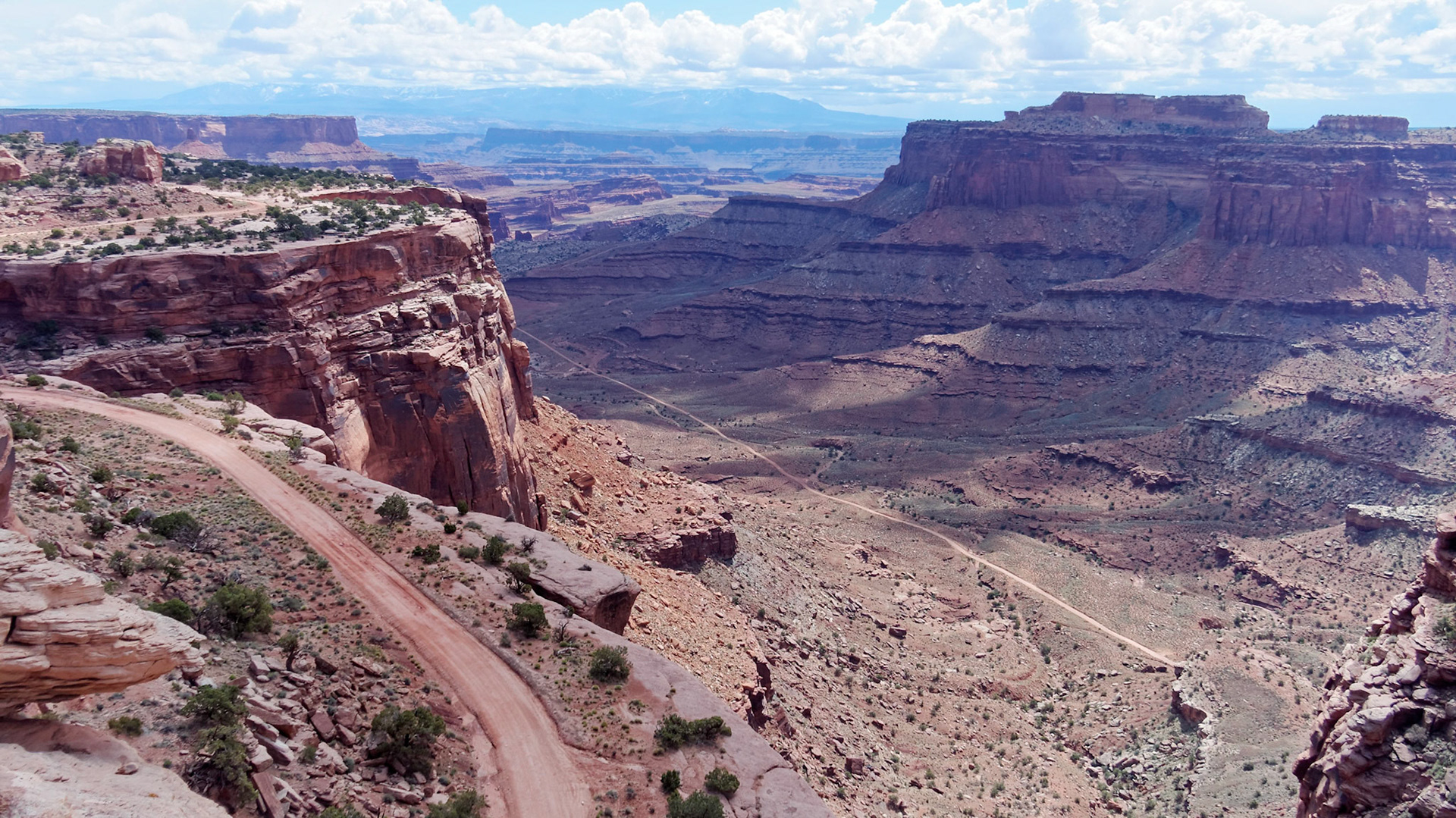
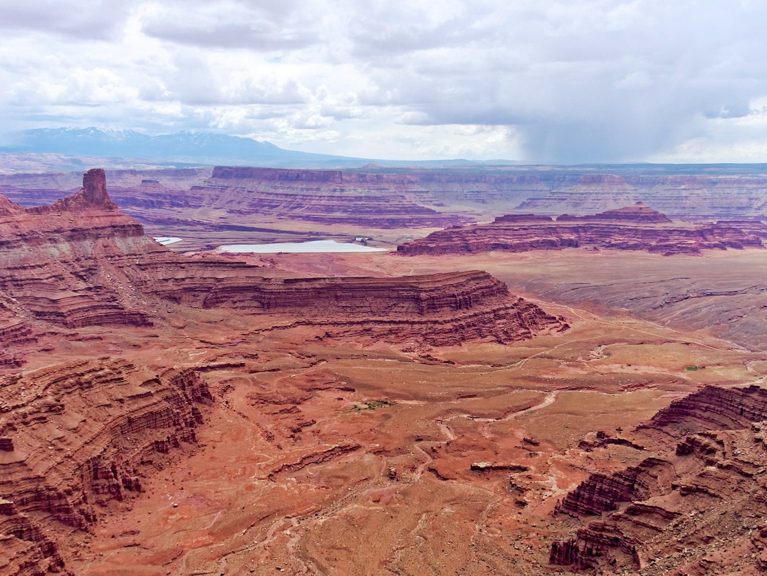
Looking down into Shafer Canyon from the overlook in Island in the Sky, Canyonlands National Park. The Shafer Trail leads to the Potash Road below Dead Horse Point and back to Moab.
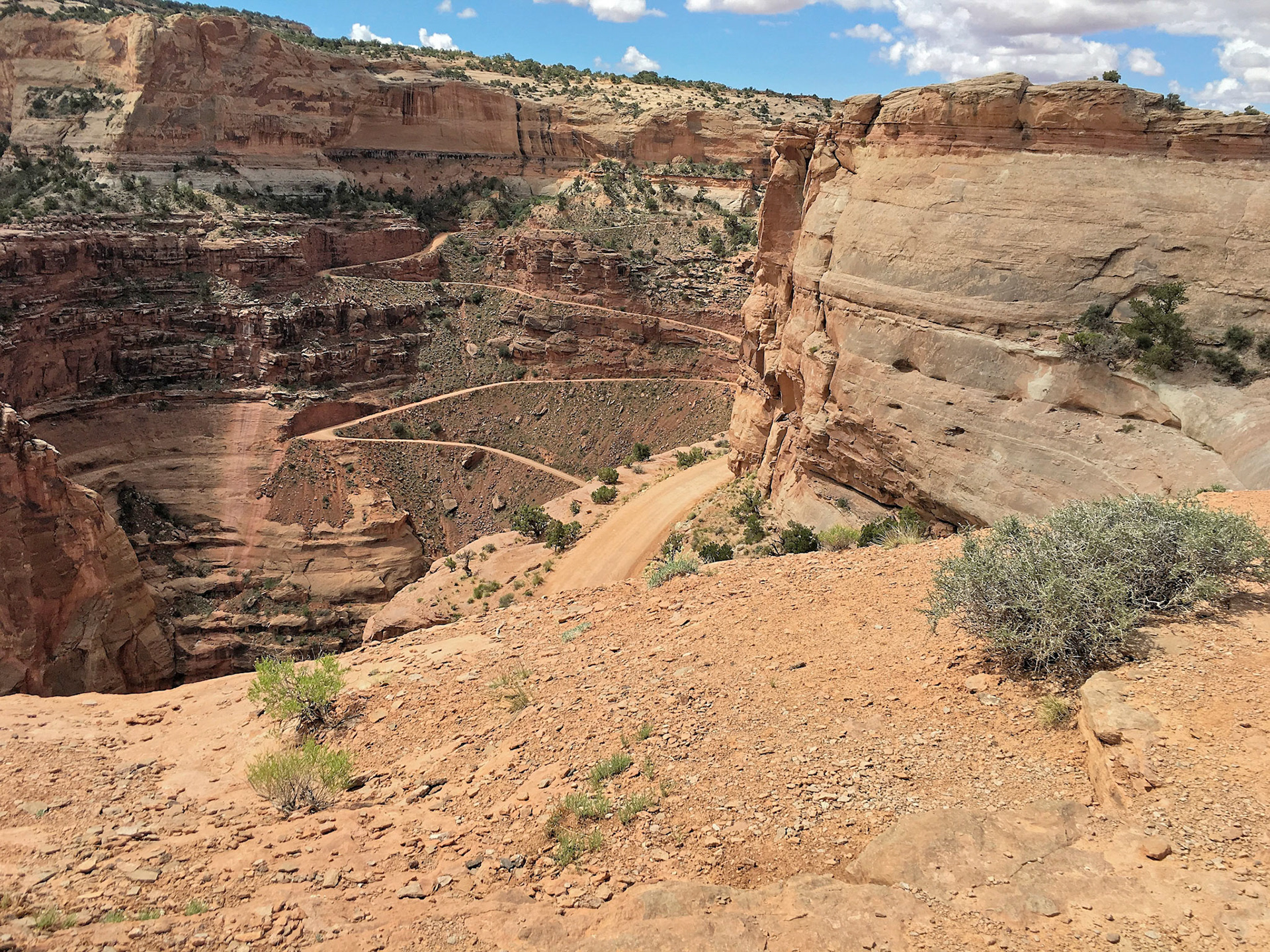
The Shafer Trail zigzags descending from Island in the Sky into Shafer Canyon, Canyonlands National Park
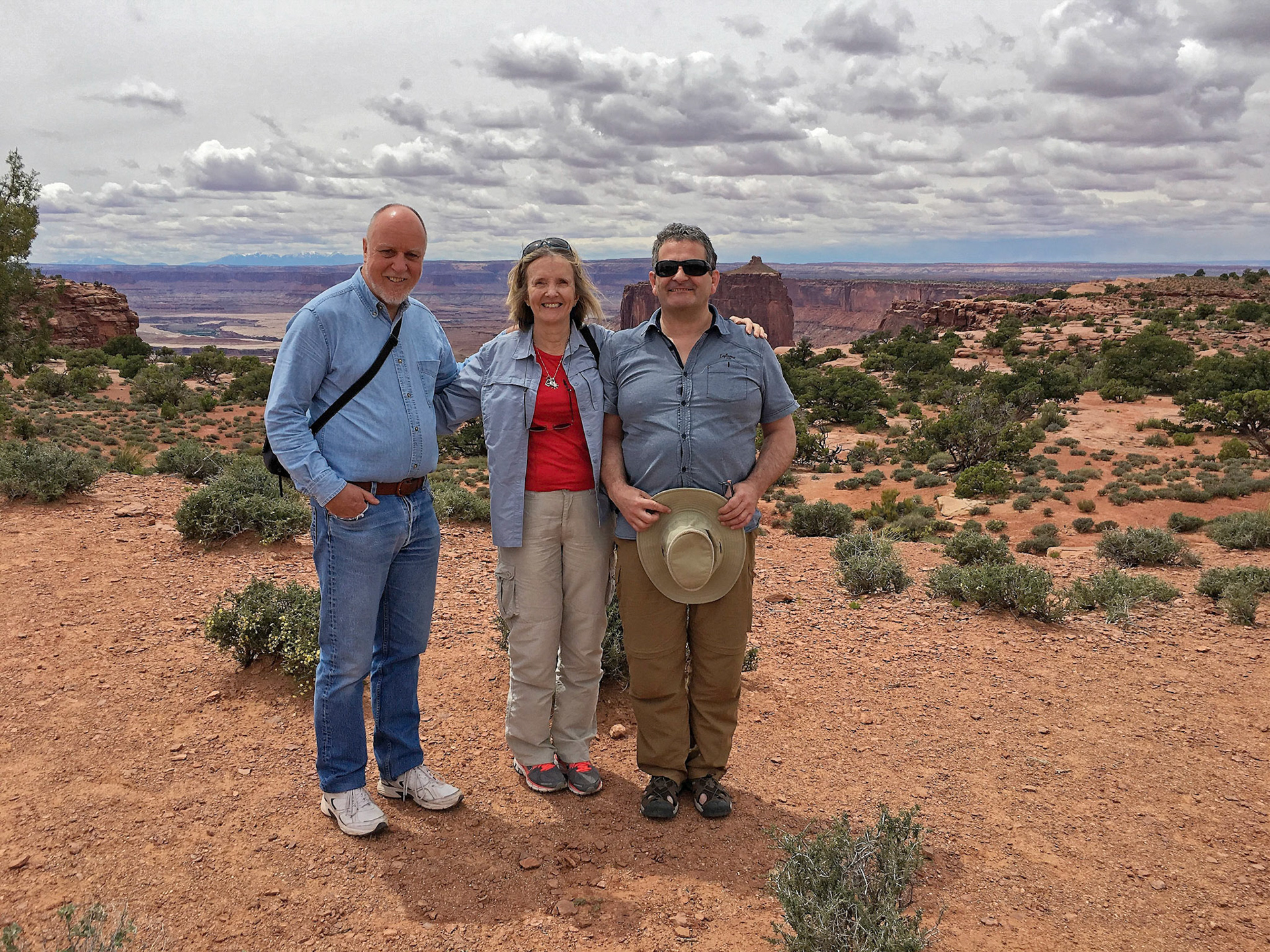
Jenny, Judith and Serge climbing back up to the road at the Shafer Canyon Overlook, Island in the Sky, Canyonlands National Park.
Looking along the south side of the Upheaval Dome Trail, Island in the Sky District, Canyonlands.
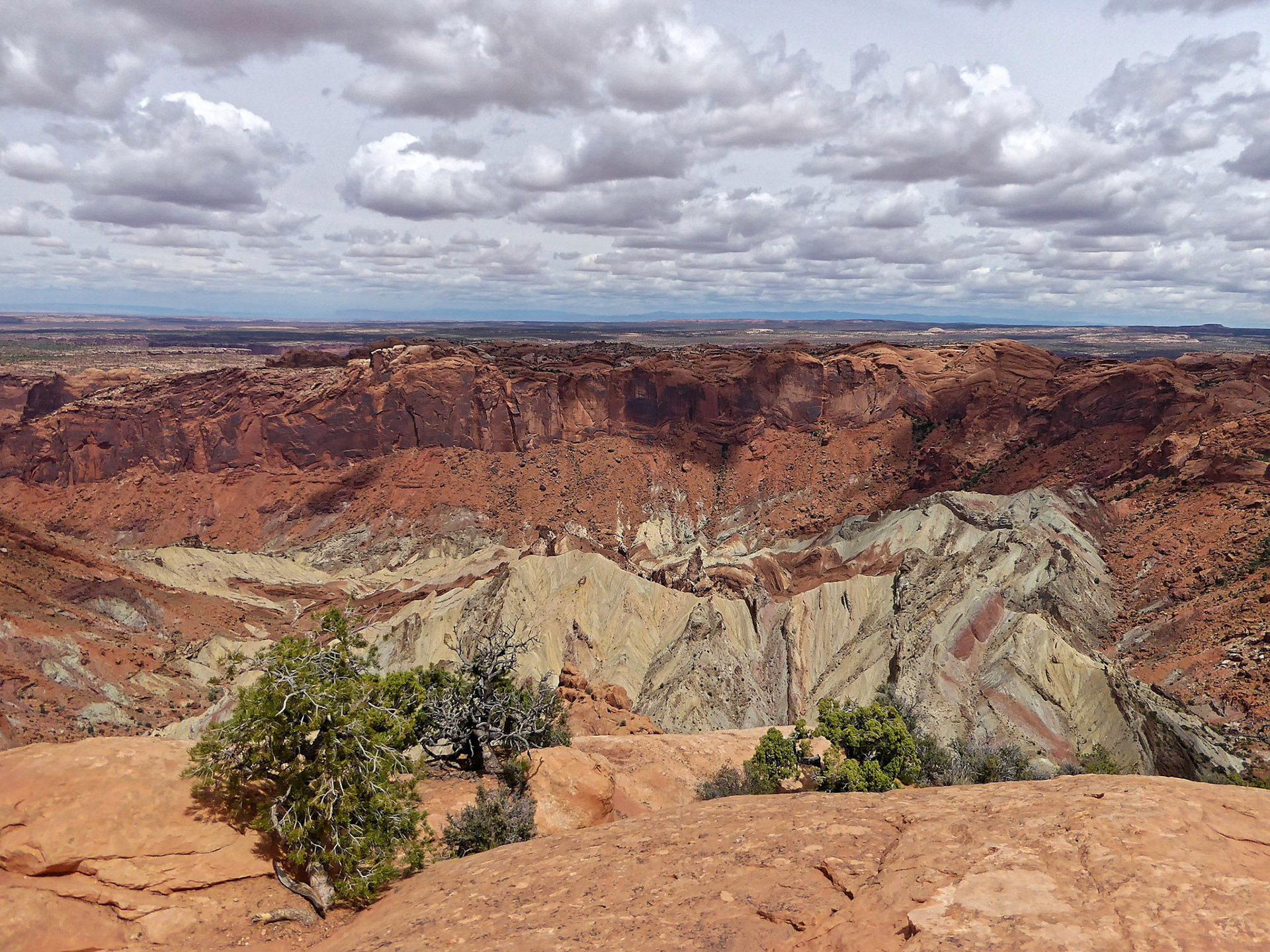
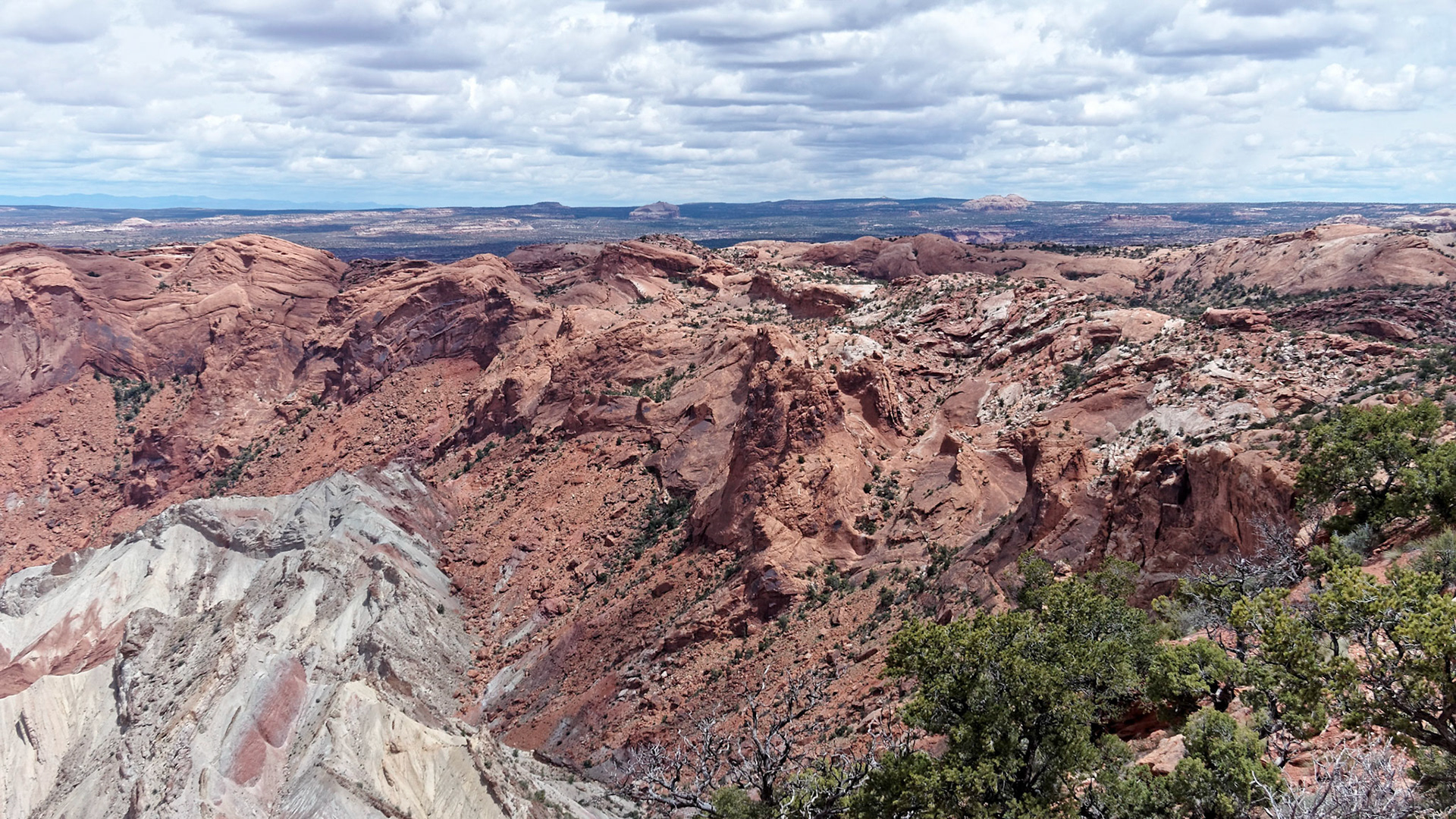
View from the south side of the trail across the Upheaval Dome, Island in the Sky, Canyonlands.
View from the south side of the trail across the Upheaval Dome, Island in the Sky, Canyonlands.
Serge and Judith on the Upheaval Dome Trail, Island in the Sky, Canyonlands.
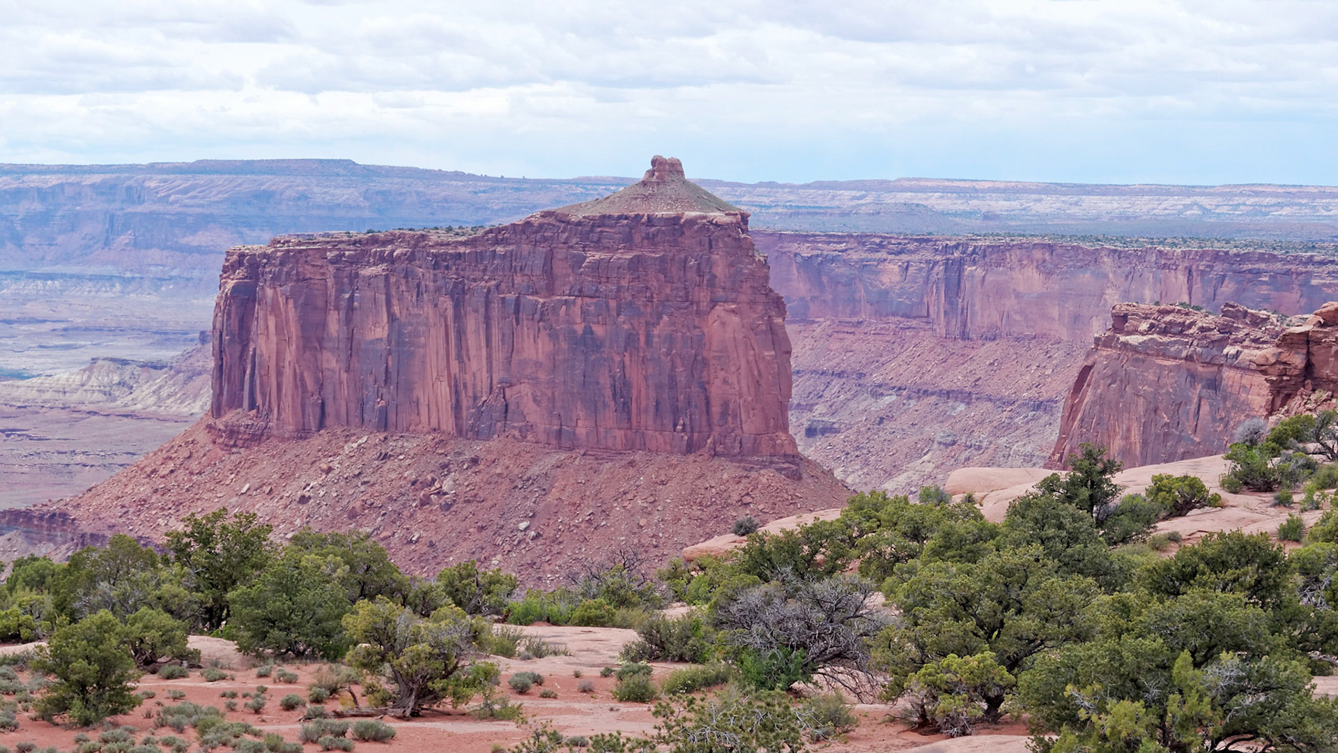
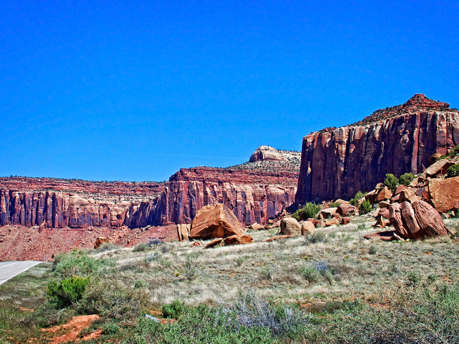
View down into Willhite Canyon from the Grand View Point Road.
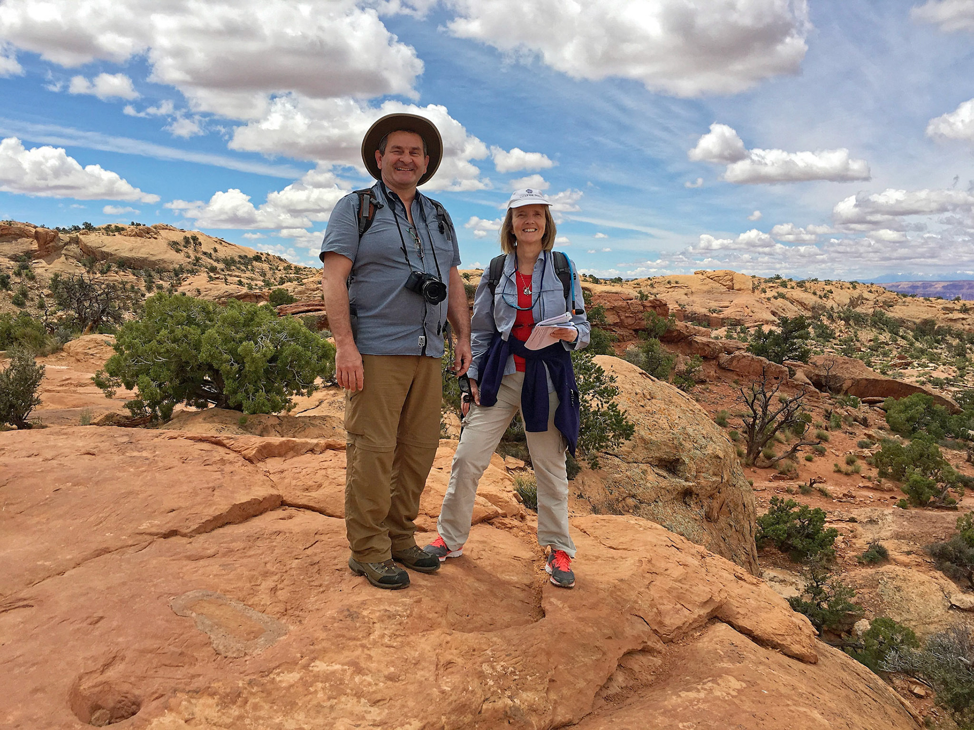
Richard, Judith and Serge in the Island in the Sky District, Canyonlands National Park.
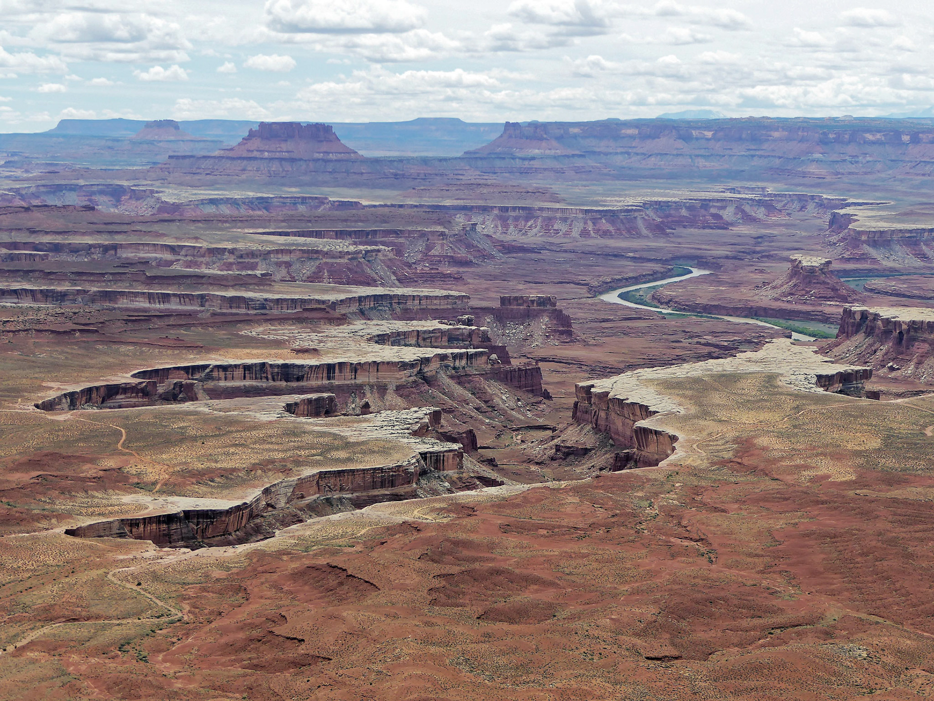
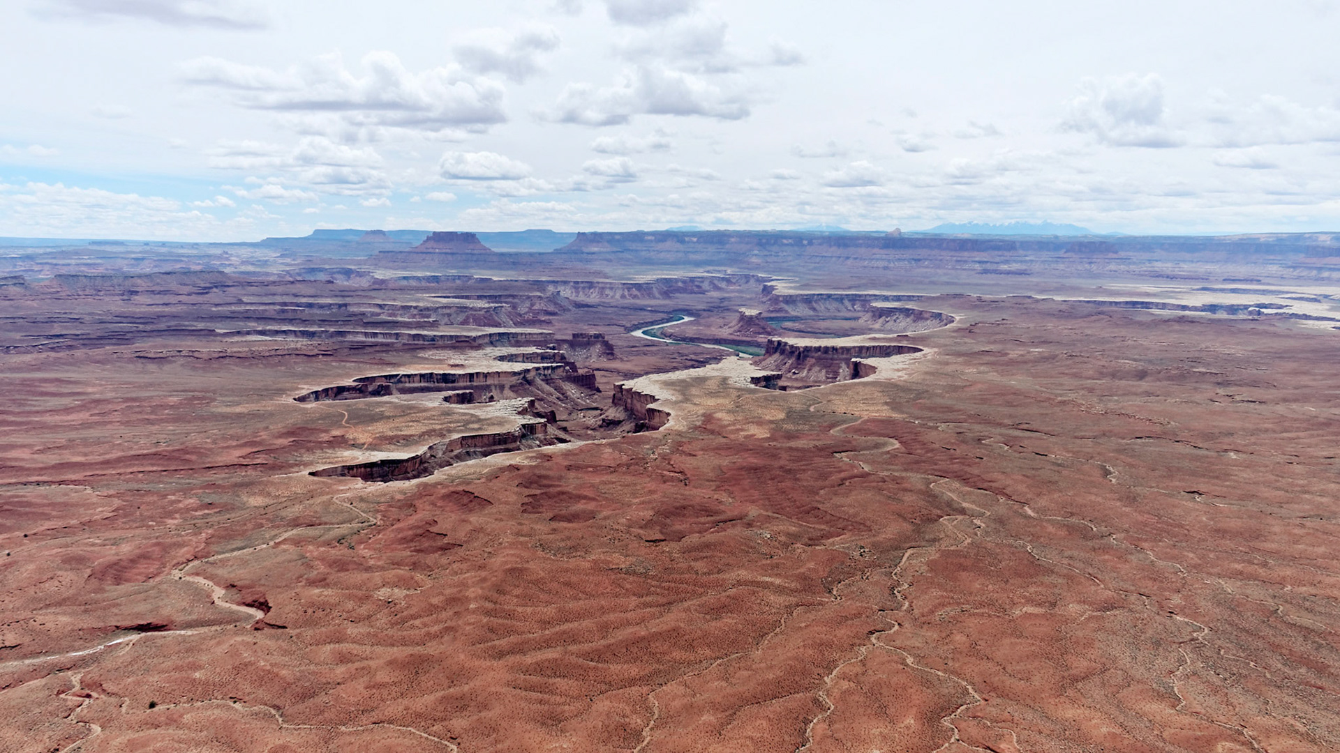
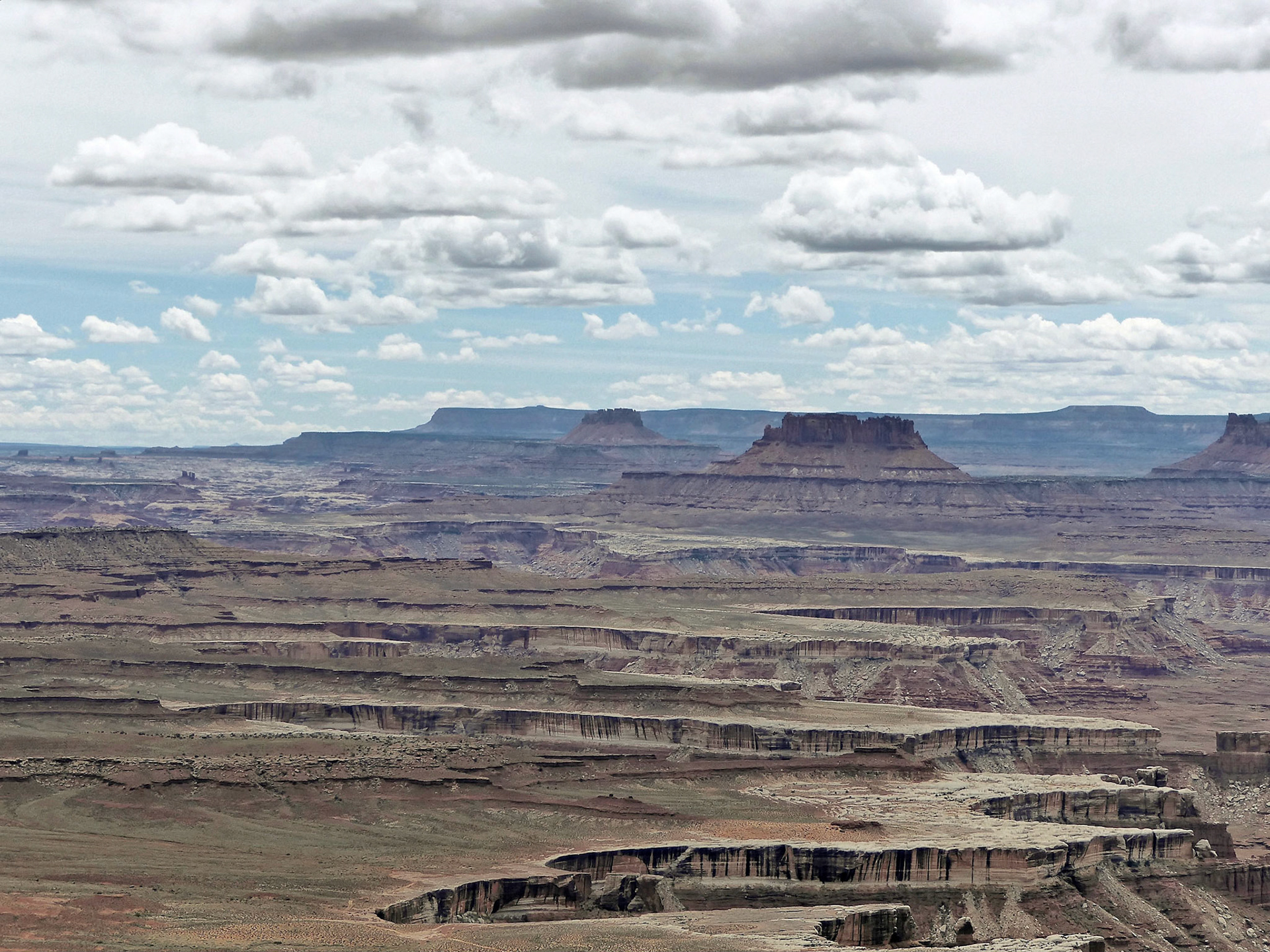
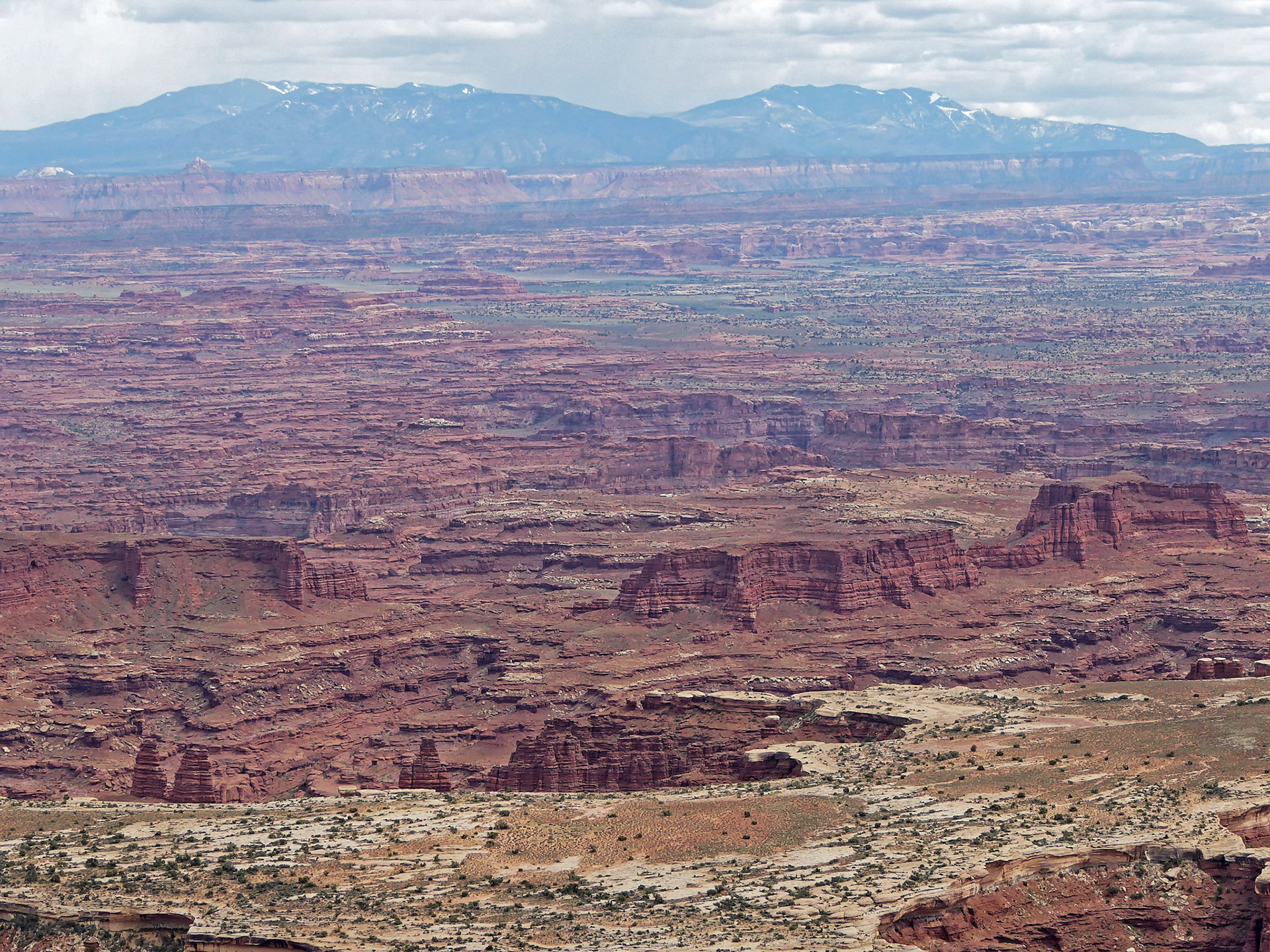
View over to the Maze from the Green River Overlook, Island in the Sky. In the distance are Elaterite and Ekker Buttes. To the right of the river is the Turks Head and in the foreground the White Rim Trail. On the horizon to the right are the Henry Mountains.
View from the Green River Overlook across the White Rim to the Maze and, on the horizon, the Henry Mountains.
View over to the Maze from the Green River Overlook, Island in the Sky. In the distance are Elaterite and Ekker Buttes. To the right of the river is the Turks Head and in the foreground the White Rim Trail. On the horizon to the right are Cleopatra's Chair and the Henry Mountains
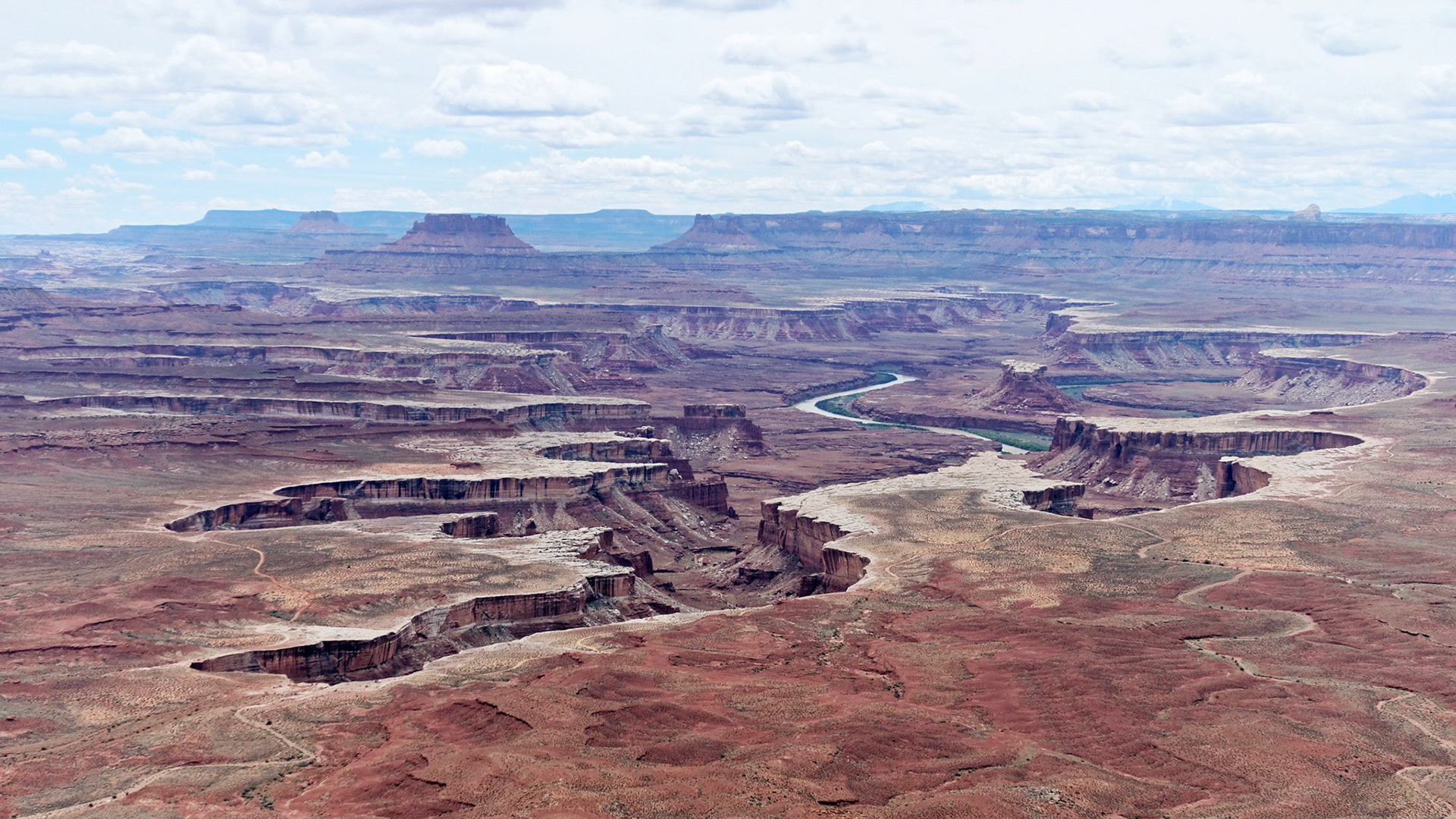
View over to the Maze from the Green River Overlook, Island in the Sky. In the center are Elaterite and Ekker Buttes.
View over to the Maze from the Green River Overlook, Island in the Sky. In the center is the Turks Head and in the foreground the White Rim Trail. On the horizon are the Henry Mountains.
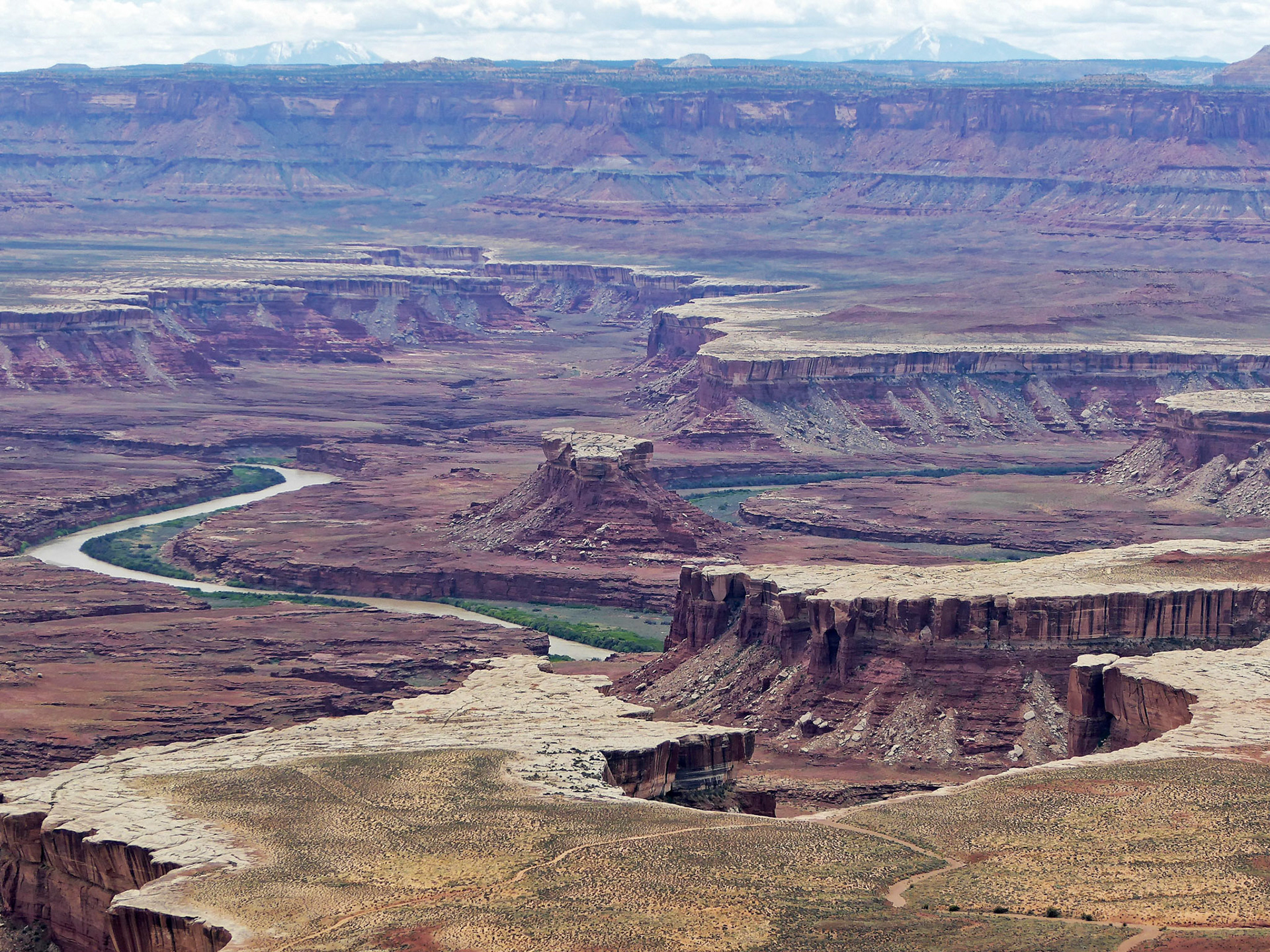
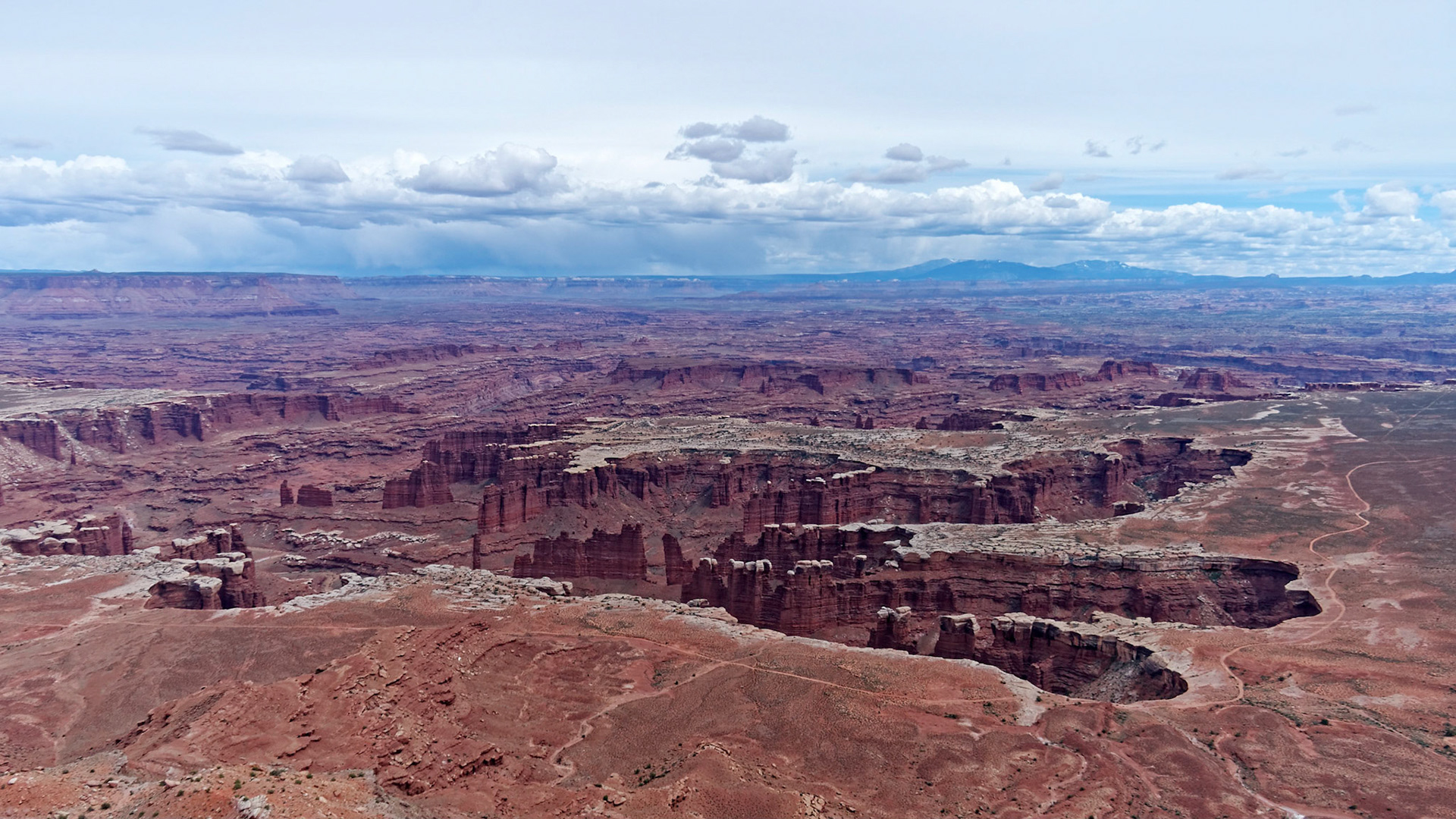
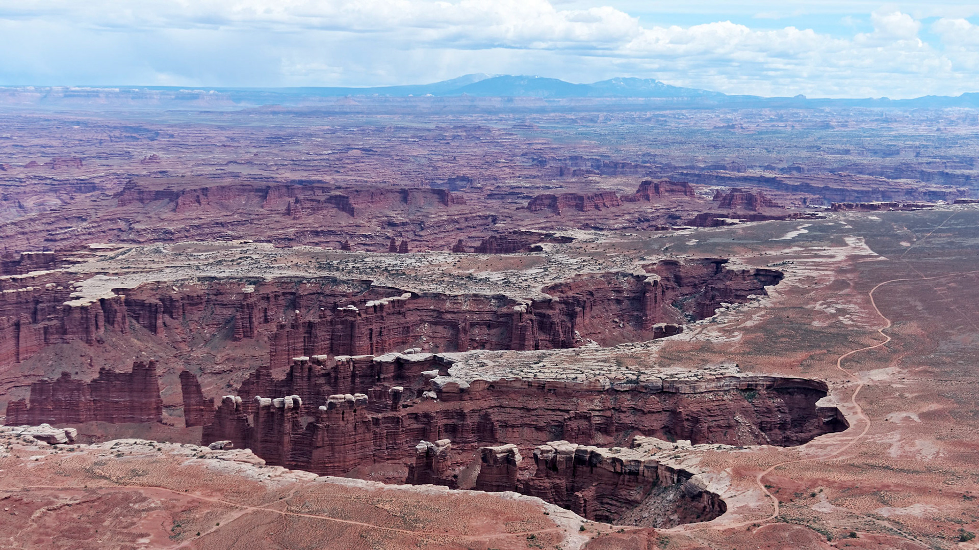
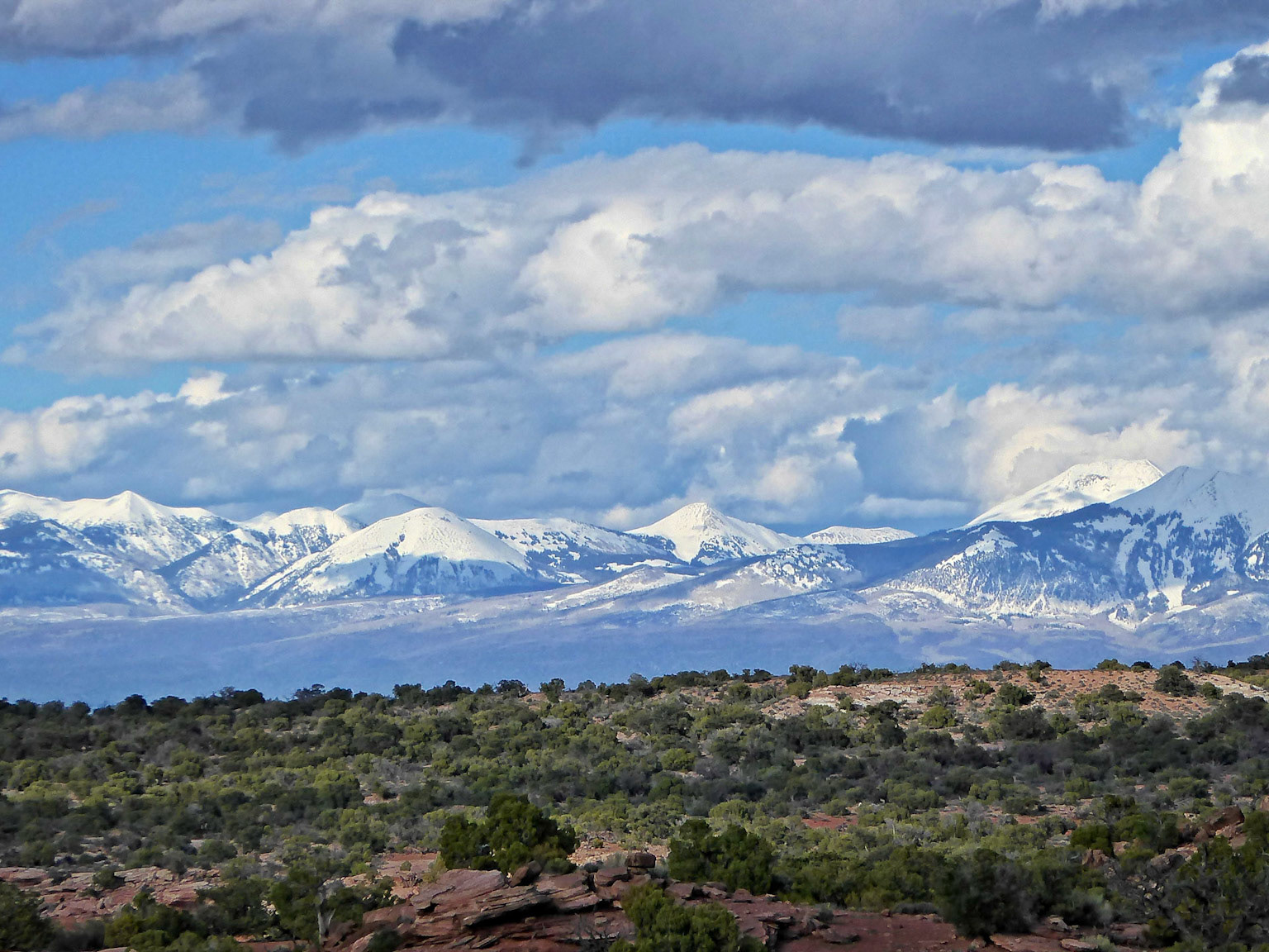
Looking south from the Grand View Point overlook, Island in the Sky, over Monument Basin to the Needles District and the Abajo Mountains beyond.
Looking south from the Grand View Point overlook, Island in the Sky, over Monument Basin to the Needles District and the Abajo Mountains beyond.
Looking south from the Grand View Point overlook, Island in the Sky, over Monument Basin to the Needles District and the Abajo Mountains beyond.
Looking south from the Grand View Point overlook, Island in the Sky, over Monument Basin to the Needles District and the Abajo Mountains on the right horizon.
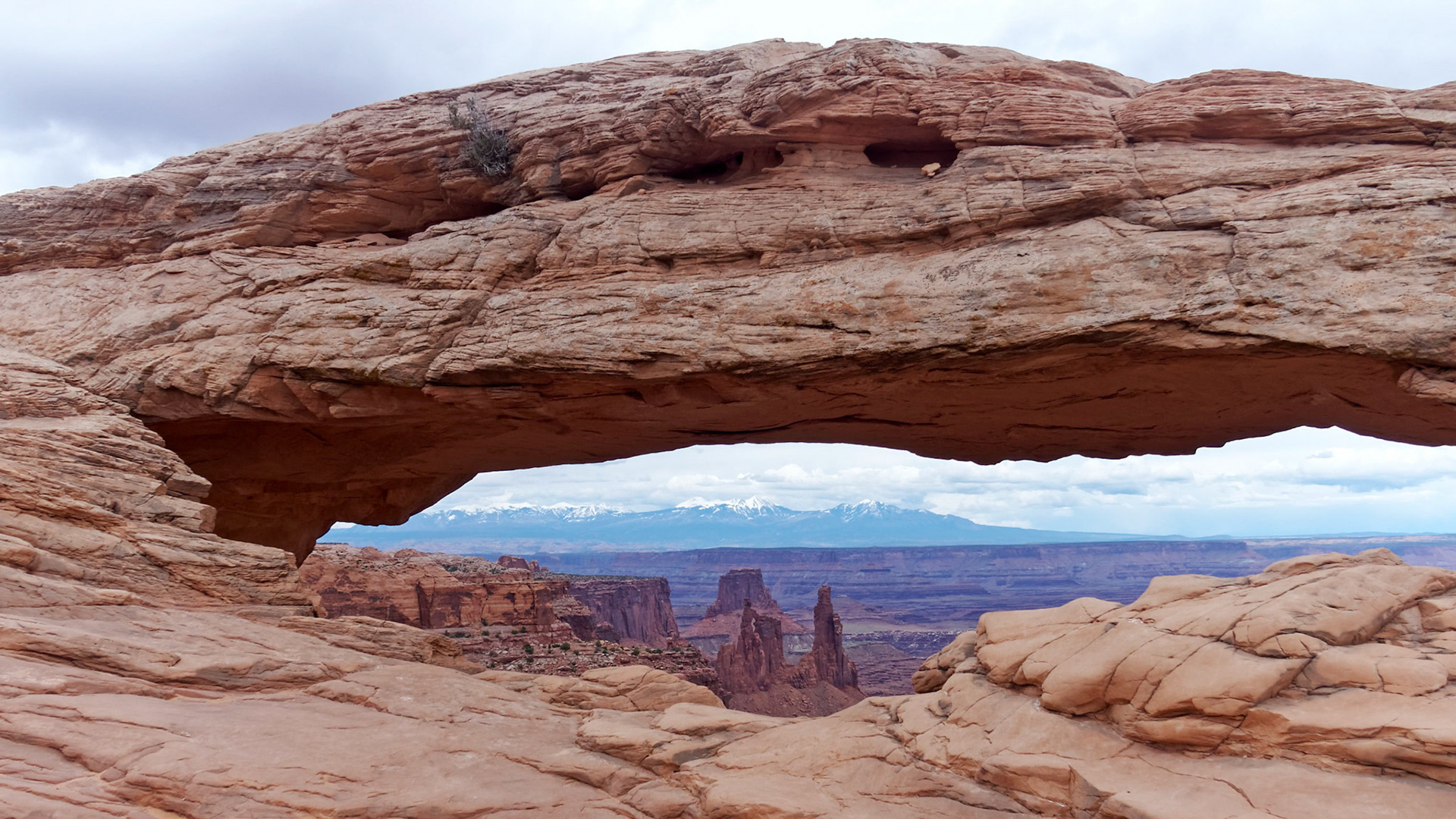
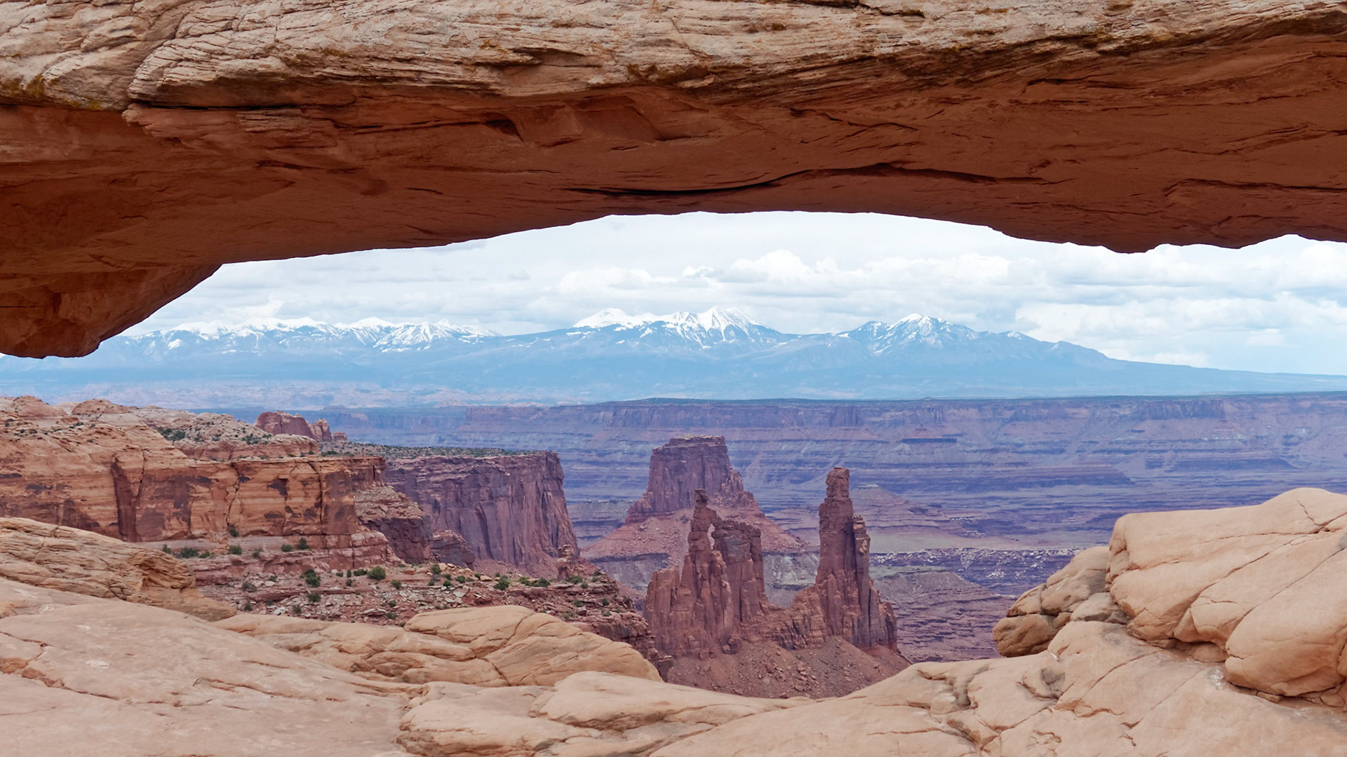
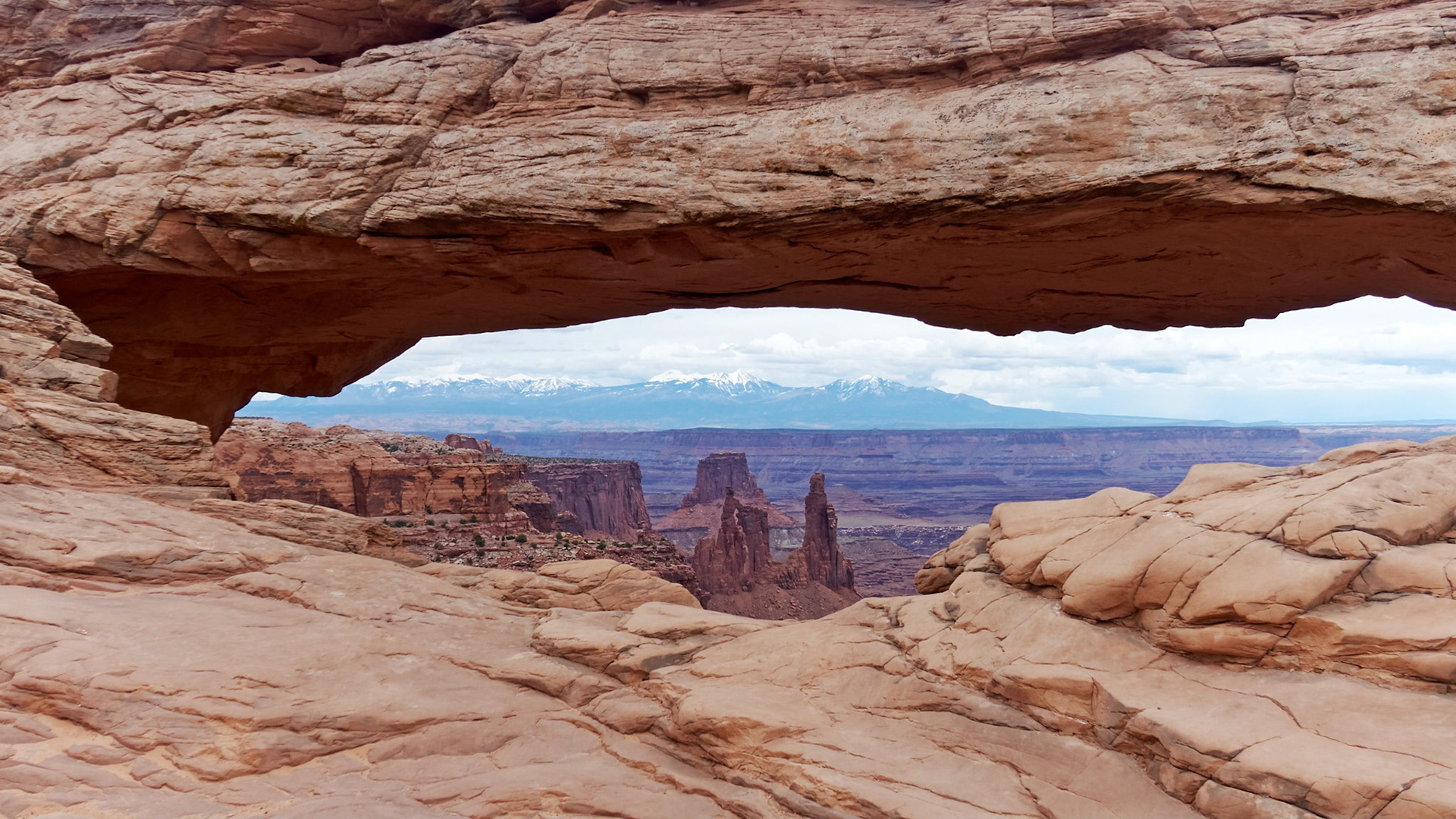
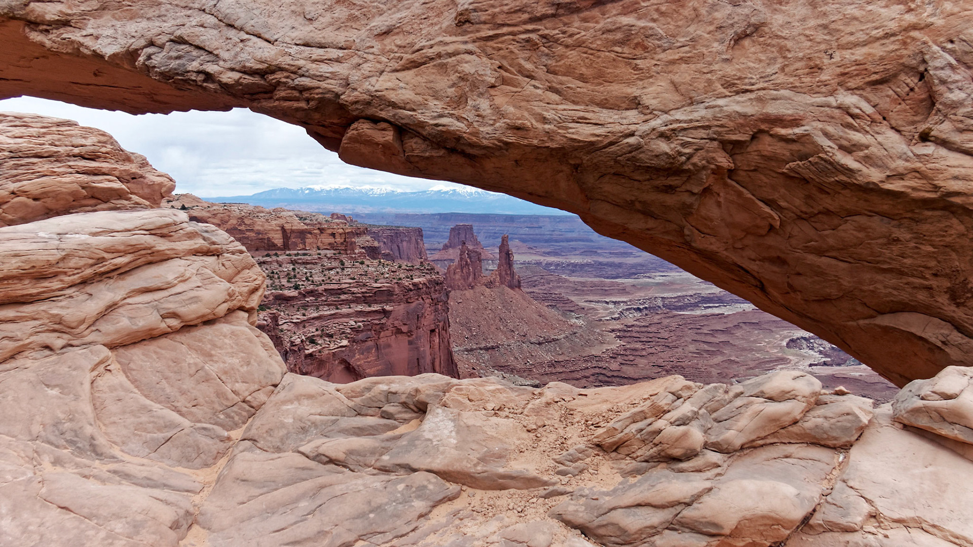
Mesa Arch, Island in the Sky, framing the Washer Woman Arch and the La Sal Mountains.
Mesa Arch, Island in the Sky, framing the Washer Woman Arch and the La Sal Mountains.
Mesa Arch, Island in the Sky, framing the Washer Woman Arch and the La Sal Mountains.
Mesa Arch, Island in the Sky, framing the Washer Woman Arch and the La Sal Mountains.